地图是一种用于显示地理数据的可视化工具。 它将信息以图形化的方式展示,帮助用户直观理解空间关系、地理分布及数据模式。地图可视化工具的类型多样,包括静态地图、动态地图、交互式地图等,常见应用于地理信息系统(GIS)、商业智能(BI)分析、市场研究等领域。
在商务应用中,地图可视化工具可以结合不同数据源,实现多维度数据分析,例如销售区域分析、客户分布分析、物流路径优化等。地图上的数据点、热力图、路径图等元素,可以动态更新,帮助用户实时掌握变化趋势,并做出更精确的决策。
一、MAP VISUALIZATION TOOL TYPES
Static Maps: These are simple, non-interactive maps that provide a snapshot of data at a particular time. They are typically used in reports, presentations, and printed materials. Static maps are easy to create and interpret but lack interactivity.
Dynamic Maps: These maps can update in real-time based on new data inputs. Dynamic maps are useful for applications like weather tracking, live traffic updates, and real-time monitoring of events. They can provide users with the most current information, helping in quick decision-making.
Interactive Maps: These maps allow users to interact with the data, such as zooming in and out, clicking on data points for more information, and filtering data layers. Interactive maps enhance user engagement and are widely used in web applications and dashboards. They provide a deeper understanding by allowing users to explore data from different angles.
二、APPLICATIONS IN BUSINESS INTELLIGENCE
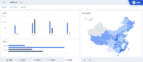
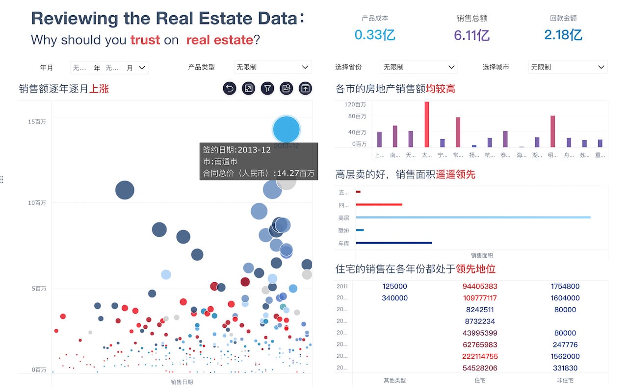
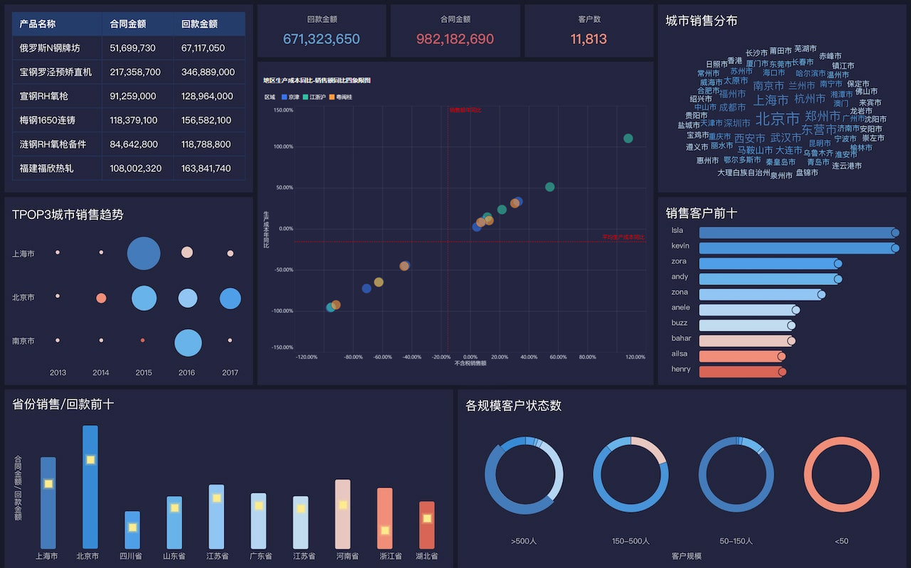
Sales Territory Analysis: By mapping out sales data, businesses can identify high-performing regions and areas that need improvement. Heat maps and choropleth maps are commonly used to visualize sales density and performance across different territories. This helps in strategic planning and resource allocation.
Customer Distribution Analysis: Mapping customer locations helps businesses understand their market reach and demographic distribution. Point maps and cluster maps can show where customers are concentrated, helping in targeted marketing and service delivery.
Logistics and Supply Chain Management: Mapping supply routes and distribution networks can optimize logistics operations. Route maps and flow maps visualize transportation paths and highlight bottlenecks or inefficiencies. This leads to improved delivery times and cost savings.
三、TOOLS FOR MAP VISUALIZATION
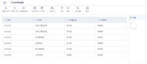
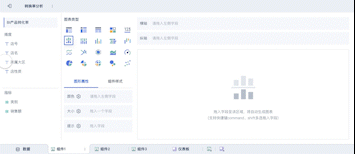
FineReport: FineReport is a powerful business intelligence tool that provides advanced map visualization capabilities. It supports various types of maps, including heat maps, point maps, and path maps, and allows for extensive customization and real-time data integration. More details can be found on the FineReport website.
FineVis: FineVis offers interactive map visualizations tailored for complex data analysis. It is particularly useful for creating dynamic and interactive maps that can be embedded into dashboards and reports. The tool supports various geospatial data formats and provides rich interactivity features. Explore more on the FineVis website.
Google Maps API: Google Maps API provides extensive mapping functionalities and is widely used in web and mobile applications. It allows for the integration of custom data layers and interactive features, making it a versatile tool for businesses.
ArcGIS: ArcGIS is a comprehensive GIS platform that offers robust map visualization tools. It supports detailed spatial analysis and can handle large datasets, making it ideal for in-depth geographic analysis and professional mapping.
四、IMPLEMENTATION STRATEGIES
Data Integration: For effective map visualization, integrating data from multiple sources is crucial. This can include internal data (sales figures, customer demographics) and external data (census data, geographic boundaries). Proper data integration ensures a holistic view and accurate analysis.
Customization and Interactivity: Customizing map visualizations to fit specific business needs enhances their usability. Interactive features such as tooltips, zoom functions, and layer toggles allow users to explore the data in more detail and gain deeper insights.
Scalability and Performance: Ensuring that map visualizations can handle large volumes of data and perform well under high demand is essential. This involves optimizing data processing and leveraging cloud-based solutions to maintain responsiveness.
User Training and Adoption: Providing training for users on how to effectively use map visualization tools ensures that the full potential of the tools is realized. This includes understanding the various features, interpreting different map types, and applying the insights gained from the visualizations in decision-making processes.
In conclusion, map visualization tools are invaluable for translating complex geographic and spatial data into actionable insights. By choosing the right tools and implementing effective strategies, businesses can enhance their data analysis capabilities and drive informed decision-making.
相关问答FAQs:
地图是什么可视化工具?
地图是一种以图形方式展示地理信息的工具,通常用于表示地球表面或特定区域的空间特征。地图能够展示各种数据,包括地形、城市分布、人口密度、交通网络等。借助地图,用户可以更直观地理解和分析这些信息,同时地图也可以通过颜色、符号和标记等元素来增强可读性和信息传递的效率。
在现代社会,地图不仅仅局限于传统纸质地图,数字地图和在线地图服务的出现使得地图的使用更加广泛和便捷。用户可以在智能手机、平板电脑或计算机上访问各种地图应用程序,获取实时的地理信息和导航服务。例如,Google Maps、百度地图和高德地图等应用提供了详细的街道视图、交通状况和公共交通信息,极大地方便了人们的出行。
地图的可视化能力使其成为许多领域的重要工具,包括城市规划、环境研究、灾害管理和市场分析等。在数据可视化的背景下,地图不仅帮助用户发现地理模式,还能揭示数据之间的关系,为决策提供支持。
地图的类型有哪些?
地图的类型多种多样,主要可以分为以下几类:
-
地形图:这种地图显示地面的自然特征,如山脉、河流、湖泊等。地形图通常使用等高线表示高度变化,帮助用户理解地形的起伏。
-
政治地图:政治地图主要显示国家、地区、城市的边界和行政区划。这类地图通常用于展示国家之间的关系和地缘政治状况。
-
主题地图:主题地图聚焦于特定主题或数据,比如人口分布、气候变化、经济活动等。通过色彩和符号的变化,这类地图能够有效传达特定的信息。
-
交通地图:这类地图专注于交通网络的展示,包括道路、铁路、航线等。交通地图可以帮助用户规划行程和选择最佳路线。
-
卫星地图:卫星地图通过卫星图像提供地表的真实影像,用户可以清晰地看到建筑物、道路和自然特征。这类地图在地理信息系统(GIS)中应用广泛。
-
在线互动地图:随着科技的发展,在线互动地图越来越流行。这类地图允许用户进行缩放、平移和信息查询,提供更为灵活的体验。
每种类型的地图都有其独特的功能和用途,用户可以根据需求选择合适的地图进行分析和使用。
如何有效利用地图进行数据分析?
利用地图进行数据分析时,用户可以遵循以下步骤,以确保获取最佳的可视化效果和信息洞察。
首先,明确分析的目标和需要展示的数据类型。了解需要回答的问题以及希望从地图中提取的信息是非常重要的。比如,是否希望分析某个地区的人口变化趋势?或者是评估特定区域的资源分布情况?
接下来,收集和准备数据。确保使用的数据是准确和最新的,并且格式适合用于地理信息系统(GIS)。数据可以来自政府统计局、卫星图像、市场调研等多种渠道。数据清洗和整理的过程对于后续分析至关重要。
然后,选择合适的地图类型和可视化工具。根据数据的特性和分析的目标,选择适合的地图类型(如热力图、点图、区域图等)以及相应的可视化工具(如ArcGIS、Tableau、Google Maps API等)。合适的工具能够帮助用户更直观地呈现数据。
在构建地图时,注意图例、标注和颜色的使用。图例应清晰易懂,能够帮助用户理解地图所传达的信息。颜色的选择应具备一定的逻辑性,避免使用可能引起误解的色彩组合。
最后,进行结果分析和解读。通过地图展示的数据可以揭示潜在的模式和趋势,用户需要结合实际情况进行深入分析。地图不仅是数据的呈现工具,更是发现问题和解决问题的重要手段。
通过上述步骤,用户可以更高效地利用地图进行数据分析,获取有价值的洞察和决策支持。地图在现代数据分析中扮演着越来越重要的角色,尤其是在需要空间分析和地理信息的领域。
本文内容通过AI工具匹配关键字智能整合而成,仅供参考,帆软不对内容的真实、准确或完整作任何形式的承诺。具体产品功能请以帆软官方帮助文档为准,或联系您的对接销售进行咨询。如有其他问题,您可以通过联系blog@fanruan.com进行反馈,帆软收到您的反馈后将及时答复和处理。